Road Network
As a result of three flood events in 2022 the Gympie region received significant damage to the majority of our road network. Many roads sustaining varying levels of damage from minor to significant. The early damage estimate places the combined cost to council between $90 - $100 million over the three floods.
Remediation and resilience building of damaged assets has a high-cost impact on Council. Where possible, Council is working with State and Federal governments to access funds through the Disaster Recovery Funding Arrangement (DRFA) which is administered by the Queensland Reconstruction Authority.
Click here to see the construction schedule and program progress
To view councils annual program, visit our Roadworks Schedule page
Works in progress
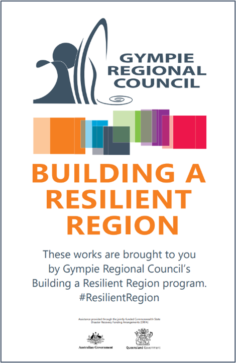
At roads identified in council's flood recovery works residents can expect to see ‘Building Resilient Region’ construction signage like the one on the right. Over the period to mid-2025 council will be delivering ‘construction packages’ on a priority basis.
 Construction Packages:
- Priority Package 01 - consists of 25 roads and was delivered by Council workforce crews. This construction package was completed in April 2024.
- Western Roads Construction Package 01 - consists of 28 roads and was delivered by an external contractor. The works on the Noosa Road and Traveston Road are now complete.
- Eastern Roads Construction Package 02 - consists of 282 roads plus a landslip site along Bella Creek Road. This construction package was completed in early July 2024.
- Eastern Roads Construction Package 03 - consists of 431 roads and is being delivered by an external contractor. This construction package is on track to be completed by early 2025.
- Western Roads Construction Package 04 - consists of 182 roads and was completed in early September 2024.
- Landslips Construction Package 05 - consists of two (2) landslip sites at Booubyjan Road and Blunder Road and were delivered by an external contractor. These works were completed in October 2024.
- Betterment Sites - consists of ten (10) betterment sites throughout the road network to provide more resilience to drainage, floodways and bridge structure approaches. Council workforce crews will be delivering these works which are already complete at Maudsley Street, Goomeri, two floodways along Cedar Pocket Road and two floodways along Moy Pocket Road. Recently Council also completed Rossmore Road floodway and have also commenced work at Kew Road and Roebuck Street. The North Deep Creek Road floodway is being delivered by an external contractor and is due for completion in December 2024. The remaining listed projects will be rolled-out through the remainder of early to mid-2025.
- Harrys Creek Road Bridge – Council has awarded the recent Bridge Replacement Package tender and construction is targeted to commence in early 2025 with a target completion date in mid-2025.
To view which roads are included in these packages see the documents at the bottom of the page.
Council are making their way through an extensive list of flood damaged roads, the roads identified are the first of many to be completed in the next few years. We thank the community for their patience.
Construction Package affected resident FAQS
-
Every road is different, please see the upcoming works schedule above. If your road doesn’t have a timeframe listed next to it, please check back at a later time. (The schedule is updated monthly). Please note all timeframes are subject to weather and construction conditions.
-
Yes. Where access issues are unavoidable, crews will discuss with property owners prior.
-
6am – 6pm unless specified otherwise in the schedule of works above.
-
The REPA (Reconstruction of Essential Public Asset) approved works for each road may vary depending on the extent of damages each section of road has sustained. QRA (Queensland Reconstruction Authority) is strict regarding the funds released for each road and only issues approvals for elected treatments on particularly damaged sections of road. Only QRA approved sections of road have received funding for repairs, resulting in varying treatments along REPA approved roads. Where applicable council is supplementing flood damage works on roads with routine maintenance activities such as formation grading, gravel re-sheeting and pavement repairs, covering sections of roads that are ineligible for flood recovery funding.
-
Construction Packages will be delivered by contractors to allow council to focus on its day to day operations. The contract is funded by the jointly-funded Commonwealth-State Disaster Recovery Funding Arrangement (DRFA).
-
With the reconstruction activities some works need to be undertaken by varied and specialist contractors, and others can be done by council crews. This could result in unsealed road grading works being undertaken prior to repairs on a sealed section of road, or vice versa. Sealed sections of roads may see drainage repairs undertaken prior to road surface repairs being performed. This logic allows reconstruction resources to be allocated to where the need is most, and works are cost-effective.
Other Common FAQs
-
Council captured detailed images of the complete road network in May/June 2022. Council has developed a mapping tool to show the location, status, and details of damages across the region. This mapping tool can be viewed above.
Should wet weather occur, locations may see on-going and new damages appear. Damage identification is being supplemented through inspections by our civil consultancy company.
-
Reconstruction works have commenced and will continue until at least 2024.
-
- Road repairs are assessed against relevant criteria associated with the Disaster Recovery Funding Arrangements (DRFA) administered through the Queensland Disaster Funding Guidelines (QDFG). Council submit damage claims and evidence to the Queensland Reconstruction Authority (QRA) prior to receiving approval to undertake reconstruction works. This is a detailed and at times lengthy process given the amount of public funds being dealt with and the extent of disaster events across Queensland in 2022.
- Eligible network damages are prioritised by Council against a multi-criteria process. The process assesses the road with respect to traffic volume, function, public transportation needs, provision of access for emergency services, regional significance (industry, agriculture, schooling), extents and type of damage. At times this may result in a major road having repairs being undertaken while minor side roads are not attended to at this stage. This rationale allows reconstruction resources to be allocated to where the need is most at that time.
-
Under the QDFG Council can only return a road asset to its pre-disaster function. Where applicable Council is supplementing flood damage works on roads with routine maintenance activities such as formation grading, gravel re-sheeting and pavement repairs, covering sections of roads that are ineligible for flooding recovery funding. Locations that have experienced continued or significant flood event damage are being assessed for QRA Betterment Funding, allowing an asset to be upgraded to increase its resilience.
-
Post flood event/s Council undertook emergency works to repair road assets to a temporary state to maintain a level of safety and function, while attending to as many such situations in a relatively short 90 day period. These locations will ultimately be assessed and repaired through the REPA funding program or if ineligible through Council routine maintenance programs. Should wet weather occur, damage to the road network is inevitable and Council will monitor the network and undertake repairs as resources allow.
-
Under the Queensland Disaster Funding Guidelines Council can only apply for funding on roads that have been maintained by Council
-
Under the Reconstruction of Essential Public Assets (REPA) definition those assets are classed as being ineligible. Funding to repair such flood damage assets will be sought through alternative funding programs if and when they become available, or future council capital works or maintenance programs.
-
Council will only be undertaking REPA works on the Council controlled road network. Works required on the State Controlled Road Network will be co-ordinated by the Department of Transport and Main Roads, e.g. Tin Can Bay Road, Mary Valley Road, Glastonbury Road, Yabba Creek Road, Bruce Highway and others.
Details of the State Controlled Road Network for the Wide Bay Burnett District can be found at https://www.tmr.qld.gov.au/Travel-and-transport/Maps-and-guides/Queensland-State-controlled-roads-and-region-maps
Issues or concerns relating to the state road network should be referred to the Department of Transport and Main Roads on Ph 13 23 80.

Construction Package Project Information Sheets
| # | Name | Size (in bytes) | Size | File Type | Download |
|---|