Mary Valley Rail Trail
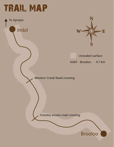 This trail is from Imbil to Brooloo and uses part of the old Mary Valley railway line. The trail is 4.7km long and suitable for walkers, mountain bikers and horse riders. It is a shared-use unsealed road.
The trail features water crossings, and you will see parts of the former railway.
Entry is from William Street, Imbil and Sutton Street, Brooloo. You can bring your dog, but please keep it on a leash at all times.
View the Mary Valley Rail Trailhead Sign.
Funded by the Queensland Government in association with Gympie Regional Council.
Mary Valley Rail Trail Feasibility Study
Gympie Regional Council undertook a feasibility study into the development of Stage two of the Mary Valley Rail Trail. This study investigated two future sections of trail from Imbil to Kandanga and from Kandanga to Amamoor following on from the section of trail that was opened in 2019 from Brooloo to Imbil.
Important information:
From 23 June to end of August 2025, weather permitting, the Imbil to Brooloo Trail will be closed due to flood restoration works. For more info: MVRT - Imbil to Brooloo Restoration Works – Gympie Regional Council